

 QuranGPT
Odisha Baitarani River Flood Crisis 2026: Modern Hydrology & Climate Resilience
An exhaustive hydrological and environmental study of the 2026 Baitarani river flood situation in Odisha, watershed management, radar telemetry, and sustainable delta governance.
The Holy Quran Team
Author
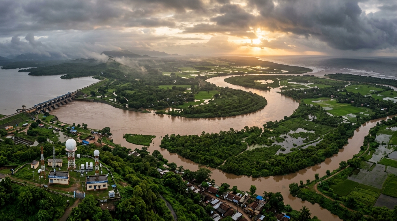
In August 2026, intense Southwest Monsoon downpours across the upper catchment areas of Jharkhand and northern Odisha caused water levels in the Baitarani, Brahmani, and Subarnarekha river systems to surge past critical danger marks. At key monitoring stations such as Akhuapada and Anandapur, peak flood discharge severely tested downstream embankments across the coastal districts of Bhadrak, Jajpur, and Kendrapara.
Managing extreme hydrological events in an era of climate volatility demands more than reactive emergency relief; it requires a systemic transition toward integrated river basin management (IRBM), advanced Doppler radar telemetry, sponge-wetland restoration, and resilient rural infrastructure.
This report offers an exhaustive scientific analysis of the Baitarani watershed, modern hydraulic modeling techniques, real-time flood early warning systems, and environmental stewardship principles.
1. Executive Summary: Baitarani River Basin Flood Matrix 2026
             BAITARANI RIVER BASIN HYDROLOGICAL MATRIX

   • Total Basin Catchment Area: ~ 10,982 sq km (Odisha: ~9,600 sq km, Jharkhand: ~1,380 sq km)
   • Total River Course Length: 360 km (Origin: Gonasika Hills, Keonjhar District)
   • Critical Hydrological Gauges: Anandapur (Warning Mark: 38.36m), Akhuapada (Danger Mark: 17.83m)
   • Primary Downstream Vulnerabilities: Embankment breaches in Jajpur (Dasarathpur block) & Bhadrak (Dhamnagar)
   • 2026 Technological Interventions: Automated Early Warning System (EWS), satellite radar altimetry
   • Environmental Mandate: Mangrove buffer restoration at Dhamra estuary and wetland rejuvenation
2. Catchment Geomorphology and Flood Dynamics
The Baitarani river exhibits distinct geomorphological zones that amplify flood vulnerability:
                    BAITARANI RIVER PROFILE AND GRADIENT

  [Upper Reach: Keonjhar Plateau]  ════► Steep Gradient, High Runoff Velocity
                 │
                 ▼
  [Middle Reach: Anandapur Plains] ════► Channel Meandering, Silt Deposition
                 │
                 ▼
  [Lower Delta: Bhadrak / Jajpur]  ════► Flat Lowland, Tidal Backwater Effect, Dhamra Estuary
                 KEY HYDROLOGICAL METRICS ACROSS BASIN

   Basin Segment   | Elevation Profile    | Primary Hydrological Risk Factors
   ----------------+----------------------+---------------------------------------
   Upper Catchment | 900m down to 200m MSL| Intense flash runoff, soil erosion from mining areas
   Middle Reach    | 200m down to 40m MSL | Sediment aggradation, narrow channel choking
   Coastal Delta   | < 20m down to Sea    | High astronomical tides, backwater blocking river discharge
3. Modern Hydrological Engineering & Radar Telemetry in 2026
To mitigate flood risks before water reaches populated deltas, the 2026 flood mitigation architecture incorporates advanced digital water technologies:
                  INTEGRATED FLOOD EARLY WARNING PIPELINE

  [Doppler Weather Radars & IMD Satellite] ──► Real-Time Precipitation Forecast
                                                      │
                                                      ▼
  [Hydrodynamic 2D River Flow Modeling]   ──► Inundation Map Simulation (6h-24h Lead Time)
                                                      │
                                                      ▼
  [State Disaster Management (ODRAF/NDRF)]──► Precision Evacuation & Barrage Gate Regulation
Strategic Hydraulic Interventions:
- Automated Sluice Gate Telemetry: Remote SCADA-controlled sluice gates at barrages that dynamically regulate flood pulses based on tidal schedules.
- Geotextile Reinforced Embankments: Replacing traditional clay bunds with synthetic geotextile mattresses and vetiver grass bio-engineering to withstand scouring currents.
- Polder-Style Retention Basins: Designating low-lying agricultural depressions as temporary seasonal storage polders to blunt peak flood waves.
4. Islamic Perspectives on Water, Rain, and Environmental Equilibrium
Water (Al-Ma') is described in the Holy Quran as the primordial source of all life, delivered in measured balance (Qadar) for the nourishment of the earth:
"And We have sent down rain from the sky in a measured amount (Bi-Qadarin) and settled it in the earth. And indeed, We are able to take it away."
— Surah Al-Mu'minun (23:18)
The term بِقَدَرٍ (Bi-Qadarin) signifies precise mathematical measurement and ecological equilibrium. When human activity disrupts natural drainage patterns, encroaches upon floodplains, or destroys protective mangrove forests, the natural balance (Mizan) is destabilized:
"Corruption has appeared throughout the land and sea by [reason of] what the hands of people have earned, so He may let them taste part of [the consequence of] what they have done that perhaps they will return."
— Surah Ar-Rum (30:41)
Ecological Water Stewardship:
- Preserving Natural River Corridors: Respecting the natural right-of-way of rivers and prohibiting unauthorized construction in active floodplains.
- Reforestation of Upper Catchments: Planting native broadleaf trees in Keonjhar hills to enhance soil infiltration and curb catastrophic siltation downstream.
- Coastal Mangrove Conservation: Expanding the Bhitarkanika and Dhamra mangrove ecosystems, which act as living bio-shields against coastal storm surges and tidal backwaters.
5. Strategic Roadmap for Sustainable Delta Governance
                   CHRONOLOGICAL WATERSHED GOVERNANCE ROADMAP

   Immediate Phase (0-3 Months): Drone-assisted breach repair & drinking water purification
   Medium Term (1-3 Years): Desilting river bottlenecks & continuous dredging at Dhamra mouth
   Long Term (3-10 Years): Comprehensive multi-purpose detention reservoirs & mangrove corridors
6. Frequently Asked Questions (FAQ)
Q1: What causes frequent flooding in the Baitarani River basin?
Flooding is caused by heavy monsoon rainfall in the upper hills of Keonjhar and Jharkhand, combined with flat downstream delta topography, narrow silted channels, and tidal backwaters at the Bay of Bengal.
Q2: How is modern technology improving flood management in 2026?
Hydrologists use 2D hydrodynamic flow modeling, automated telemetry gauges, satellite precipitation tracking, and geotextile embankments to provide 24-hour advance warning and prevent catastrophic breaches.
Q3: What is the long-term ecological solution for Odisha's river deltas?
Long-term resilience requires watershed-scale reforestation in upper catchments, wetland and mangrove buffer protection, and strict regulation against floodplain encroachment.
7. Conclusion
The 2026 Baitarani flood crisis highlights the critical imperative of harmonizing modern engineering with ecological wisdom. By respecting natural river dynamics, restoring protective wetlands, and deploying advanced hydrological monitoring, communities can achieve lasting resilience and protect lives and livelihoods across generations.