

 QuranGPT
Himalayan Catastrophe: Glacial Avalanche Triggers Massive Flash Floods at Nepal-China Border; Indian Air Force Mobilizes Humanitarian Airlift
A comprehensive disaster management, glaciology, and regional humanitarian report on the devastating transboundary flash floods caused by a high-altitude ice-rock avalanche along the Nepal-Tibet border, detailing Indian Air Force C-17 relief sorties, NDRF specialized teams, and trans-Himalayan flood telemetry.
The Holy Quran Team
Author
Himalayan Catastrophe: Glacial Avalanche Triggers Massive Flash Floods at Nepal-China Border; Indian Air Force Mobilizes Humanitarian Airlift
A catastrophic trans-Himalayan natural disaster has struck the rugged borderlands between Nepal’s Sindhupalchok and Rasuwa districts and Tibet, China, after a massive high-altitude ice-rock avalanche collapsed into a glacial moraine lake, triggering violent flash floods that swept down the Bhotekoshi and Trishuli river valleys.
The torrential wall of mud, boulders, and glacial water pulverized bridges, severed the Araniko Highway transit corridor, and inundated dozens of riverside trading settlements.
Confirmed casualties have exceeded 150 fatalities, with over 750 individuals reported missing, including more than 100 Indian commercial truck drivers, pilgrims, and infrastructure workers stationed along the cross-border highway corridor.
In an immediate, large-scale humanitarian response, Prime Minister Narendra Modi spoke with Nepal’s Prime Minister, pledging India’s unconditional support under "Operation Sahayata" (Operation Assistance).
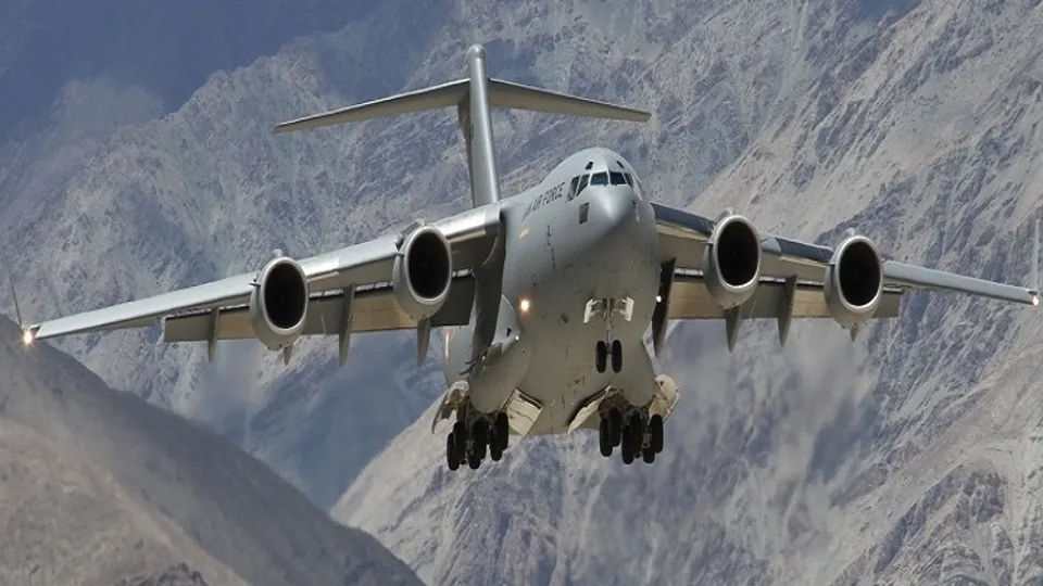
The Indian Air Force (IAF) mobilized heavy-lift C-17 Globemaster III and C-130J Super Hercules transport aircraft from Hindon Air Force Station, dispatching specialized National Disaster Response Force (NDRF) urban search-and-rescue teams, mobile satellite trauma surgical units, and tons of emergency rations and water purification tablets to Kathmandu.
1. Geophysical Anatomy: The Ice-Rock Avalanche Cascade
Satellite Synthetic Aperture Radar (SAR) imagery captured by the Indian Space Research Organisation (ISRO) and international cryosphere centers mapped the exact sequence of the disaster:
graph TD
    A["Unprecedented High-Altitude Summer Thermal Spike in High Himalayas"] --> B["Massive 4-Million-Cubic-Meter Hanging Glacier & Bedrock Detachment"]
    B --> C["Free-Fall into Glacial Moraine Lake: Creates 35-Meter Displacement Tsunami"]
    C --> D["Moraine Dam Breach: 12 Million Cubic Meters of Debris-Laden Flood Rush Down Bhotekoshi"]
    D --> E["Destruction of Hydroelectric Dams, Bridges & Araniko Highway in Nepal"]
    E --> F["Downstream Alert in Northern Bihar: Kosi & Gandak River Basins Monitored"]
Key Geological Telemetry:
- Velocity of the Flood Surge: The debris flow traveled down narrow river gorges at speeds exceeding 45 kilometers per hour, carrying car-sized granite boulders that battered hydroelectric turbine powerhouses.
- Transboundary Impact: Floodwaters triggered emergency flood alerts across downstream barrages in Northern Bihar (India), where state disaster authorities immediately activated flood embankments along the Kosi and Gandak rivers.
2. Indian Air Force & NDRF Humanitarian Mobilization
The swift deployment of Indian disaster relief assets reflects India’s established doctrine as the primary First Responder in South Asia:
| Humanitarian Asset / Unit | Deployment Location | Operational Mission |
|---|---|---|
| IAF C-17 Globemaster III | Tribhuvan International Airport (Kathmandu) | Airlifting heavy excavator earth-movers, satellite communication nodes, and 40 tons of relief supplies. |
| IAF Mi-17V5 Helicopters | Forward Helipads in Dhunche & Tatopani | High-altitude evacuation of stranded pilgrims and injured villagers from cutoff valleys. |
| NDRF Specialized Batallion (8th Bn) | Ground Zero (Sindhupalchok & Rasuwa) | Canine search units, acoustic life-detectors, and inflatable river rescue motorized boats. |
| Army Medical Corps (AMC) Field Hospital | Trishuli Base Hospital | Setting up a 50-bed emergency trauma surgical triage bay with portable oxygen generators. |
3. Climate Vulnerability in the Third Pole
The disaster has reignited urgent scientific discussions regarding the accelerating climate vulnerability of the Hindu Kush Himalayan (HKH) region—often referred to as Earth's "Third Pole":
- Accelerating Glacial Melt: Over 200 high-risk Glacial Lakes in the Himalayas have expanded by more than 300% over the past three decades due to rising atmospheric temperatures.
- The Need for Transboundary Early Warning Systems: Glaciologists urge India, Nepal, Bhutan, and China to establish real-time, shared automated lake-level sensor grids and satellite radar alerts to warn downstream populations hours before moraine dams burst.
4. Conclusion: Brotherhood in the Face of Himalayan Adversity
The disaster in the high valleys of Nepal is a solemn reminder of nature's formidable power and the shared geographical destiny uniting the nations of the subcontinent.
Through the swift, selfless courage of Indian rescue personnel and the unbreakable resilience of the Nepali people, Operation Sahayata stands as an enduring testament to deep regional brotherhood—proving that when disaster strikes the roof of the world, we stand together as one human family.