

 QuranGPT
The Lost City of Ubar (Iram of the Pillars): NASA Satellite Radar & Quranic Geo-History
Discover how NASA spaceborne radar and desert excavations uncovered the lost fortress of Ubar in Oman, validating the Quranic history of Iram of the Pillars.
The Holy Quran Team
Author
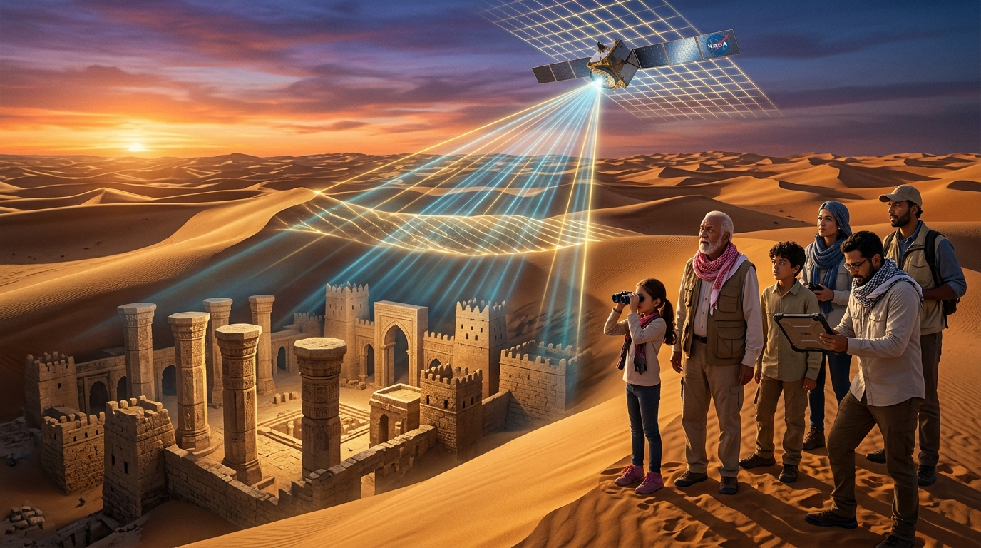
For centuries, Western historians and 20th-century orientalists dismissed the Quranic narrative of Iram of the Pillars (Iram Dhat al-'Imad) and the ancient civilization of 'Aad as legendary folklore or Arabian myth. Buried beneath hundreds of feet of shifting, hyper-arid sand in the forbidding Rub' al-Khali (The Empty Quarter) desert, the lost trade metropolis was famously dubbed the "Atlantis of the Sands" by British explorer T.E. Lawrence.
أَلَمْ تَرَ كَيْفَ فَعَلَ رَبُّكَ بِعَادٍ • إِرَمَ ذَاتِ الْعِمَادِ • الَّتِي لَمْ يُخْلَقْ مِثْلُهَا فِي الْبِلَادِ
"Have you not considered how your Lord dealt with 'Aad — [with] Iram, who had lofty pillars, the likes of which had never been created in the land?"
— Surah Al-Fajr (89:6–8)
In the late 20th century, a historic convergence of NASA satellite radar remote sensing, geophysical imaging, and ground excavations at Shisr in southern Oman unmasked the physical reality of this ancient civilization. Spaceborne radar beams penetrated the desert sands to reveal ancient caravan superhighways converging upon a fortified citadel with monumental octagonal pillars, corroborating the precise historical accounts revealed in the Holy Quran over 1,400 years ago.
1. The Quranic Account of 'Aad and Iram: Architecture and Affluence
The Holy Quran provides detailed geographical and architectural profiles of the civilization of 'Aad and their central metropolis:
أَتَبْنُونَ بِكُلِّ رِيعٍ آيَةً تَعْبَثُونَ • وَتَتَّخِذُونَ مَصَانِعَ لَعَلَّكُمْ تَخْلُدُونَ • وَإِذَا بَطَشْتُم بَطَشْتُمْ جَبَّارِينَ
"Do you construct on every elevation a sign, amusing yourselves, and take for yourselves palaces and fortified fortresses that you might abide eternally? And when you strike, you strike as tyrants."
— Surah Ash-Shu'ara (26:128–130)
وَاذْكُرْ أَخَا عَادٍ إِذْ أَنذَرَ قَوْمَهُ بِالْأَحْقَافِ وَقَدْ خَلَتِ النُّذُرُ مِن بَيْنِ يَدَيْهِ وَمِنْ خَلْفِهِ أَلَّا تَعْبُدُوا إِلَّا اللَّهَ إِنِّي أَخَافُ عَلَيْكُمْ عَذَابَ يَوْمٍ عَظِيمٍ
"And mention the brother of 'Aad [Prophet Hud], when he warned his people in the wind-curved sand dunes (Al-Ahqaf)..."
— Surah Al-Ahqaf (46:21)
Distinctive Quranic Markers of Iram:
- Dhat al-'Imad (Possessors of Lofty Pillars): The city was distinguished by monumental columned architecture, towers, and palatial stone pillars unique in the region.
- Geographical Location in Al-Ahqaf: Situated among the vast, wind-sculpted sand dunes of southern Arabia (the modern borderlands of Oman, Yemen, and Saudi Arabia).
- Unrivaled Engineering & Wealth: Flourishing as a wealthy hub along the ancient frankincense trade route ("the likes of which had never been created in the land").
- Catastrophic Collapse and Oblivion: Abandoned and swallowed by the earth following severe climatic desiccation and a violent, shrieking windstorm (Sarsar 'Atiyah - Surah Al-Haqqah 69:6).
2. Spaceborne Radar Discovery: How NASA Penetrated the Desert Sands
For decades, ground expeditions failed to locate the lost city because shifting dunes continually erase surface landmarks. The breakthrough came through spaceborne remote sensing pioneered by filmmaker Nicholas Clapp, geologist Dr. Ronald Blom (NASA Jet Propulsion Laboratory), and archaeologist Dr. Juris Zarins.
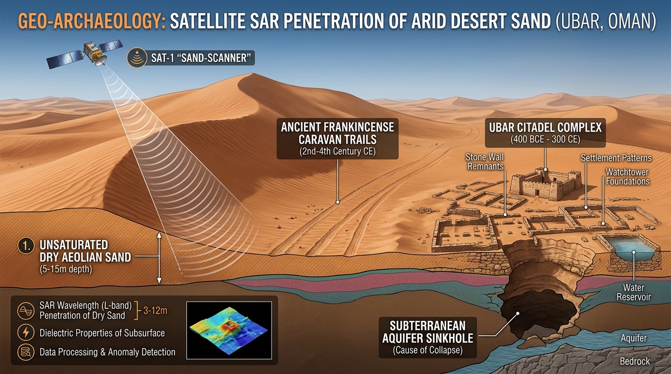
A. Synthetic Aperture Radar (SAR) Mechanics
In 1984 and 1994, NASA deployed Imaging Radar (SIR-C / X-SAR) aboard the Space Shuttle Endeavour:
- L-Band and C-Band Wavelengths: Because the hyper-arid sands of the Rub' al-Khali contain virtually zero moisture, long-wavelength microwave radar pulses penetrated through 2 to 5 meters (6 to 16 feet) of loose sand dunes.
- Dielectric Contrast: The radar reflected off the dense, compacted bedrock and gravel beds underneath the loose sand, highlighting ancient caravan tracks packed hard by the hooves of thousands of camels over centuries.
- Convergence at Shisr: Digital image processing revealed that multiple regional caravan highways, originating across Arabia, converged at a single remote desert water well in Shisr, Oman.
| Archaeological Parameter | Historical / Scientific Metric | Significance |
|---|---|---|
| Primary Trade Commodity | High-grade Boswellia sacra Frankincense | Valued equal to its weight in gold in ancient Rome, Egypt, and Persia |
| Active Epoch | ~900 BCE to 300–400 CE | Thrived for over a millennium before sudden geological collapse |
| Radar Technology | Shuttle Imaging Radar (SIR-C / X-SAR) | First documented use of orbital space radar to discover a lost ancient city |
| Architectural Layout | Octagonal fortified citadel with corner towers | Perfectly mirrors the Quranic description Dhat al-'Imad (Possessors of Pillars) |
3. Ground Excavations: Uncovering the Pillars of Shisr
Beginning in 1992, an international team of archaeologists led by Dr. Juris Zarins and Sir Ranulph Fiennes began excavating beneath the sand at Shisr.
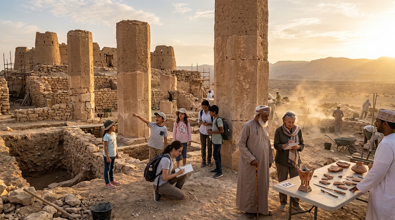
A. The Octagonal Citadel and Monumental Columns
Excavators unearthed a massive, fortified stone complex:
- Towering Octagonal Pillars: At the corners of the outer curtain walls stood tall, thick pillars built of cut limestone masonry, measuring approximately 3 meters in diameter and up to 10 meters in height.
- The Central Watchtowers: The fortified towers were designed to guard the vital subterranean water well and protect precious shipments of frankincense.
- Global Trade Artifacts: Excavations yielded Hellenistic pottery shards, Roman glass, Persian glazed ceramics, and ancient clay incense burners, proving that this desert citadel was an international trading hub connecting Rome, Alexandria, and Mesopotamia.
B. The Geo-Hydrological Collapse
Archaeological stratigraphy solved the mystery of the city's sudden demise:
- The fortress had been built directly over a massive limestone subterranean cavern containing an abundant artesian aquifer.
- As the civilization expanded, excessive groundwater extraction combined with severe regional climate aridification hollowed out the cavern ceiling.
- The weight of the heavy stone towers and columns caused the cavern roof to undergo catastrophic structural collapse, plunging major sections of the fortress, walls, and pillars into a giant sinkhole before being buried by advancing desert dunes.
4. The Prophetic Legacy and Ethical Reflections: The Demise of 'Aad
In Islamic theology, the rediscovery of ancient ruins is not merely an academic novelty, but a moral warning ('Ibrah) for human conscience.
فَأَمَّا عَادٌ فَاسْتَكْبَرُوا فِي الْأَرْضِ بِغَيْرِ الْحَقِّ وَقَالُوا مَنْ أَشَدُّ مِنَّا قُوَّةً ۖ أَوَلَمْ يَرَوْا أَنَّ اللَّهَ الَّذِي خَلَقَهُمْ هُوَ أَشَدُّ مِنْهُمْ قُوَّةً ۖ وَكَانُوا بِآيَاتِنَا يَجْحَدُونَ
"As for 'Aad, they were arrogant upon the earth without right and said, 'Who is greater than us in strength?' Did they not see that Allah who created them was greater than them in strength? But they were denying Our signs."
— Surah Fussilat (41:15)
A. The Trap of Materialistic Arrogance
The civilization of 'Aad possessed the most advanced civil engineering, wealth, and physical strength of their era. Yet, their arrogance (Kibr) led them to reject the monotheistic call of Prophet Hud (AS), oppress the weak, and boast in their invulnerability.
B. The Prophetic Humility Before Natural Forces
The Prophet Muhammad ﷺ maintained profound humility whenever he witnessed violent winds, recalling how the mighty storm dismantled the pride of 'Aad:
Narrated Aisha (may Allah be pleased with her):
Whenever a strong wind blew, the Prophet ﷺ would say:
"O Allah, I ask You for the good of it, the good within it, and the good with which it has been sent, and I seek refuge in You from its evil, the evil within it, and the evil with which it has been sent (Allahumma inni as'aluka khayraha wa khayra ma fiha...)."
— Sahih al-Bukhari #3206, Sahih Muslim #899
5. Educational and Spiritual Lessons for All Generations
The discovery of the Lost City of Ubar offers timeless inspiration across every stage of life:
- For Children and Students: A thrilling demonstration of modern science—showing how space satellites, physics, and radar imaging can peer beneath desert sands to uncover real-world history.
- For Adults and Researchers: A profound testament to the historical precision of the Quran, demonstrating that historical references once doubted by secular critics continue to be substantiated by empirical archaeology.
- For Elders and Thinkers: A humbling reminder of the fleeting nature of worldly power, wealth, and monumental architecture. Real enduring legacy lies in faith, justice, and humility before the Creator.
أَفَلَمْ يَسِيرُوا فِي الْأَرْضِ فَيَنظُرُوا كَيْفَ كَانَ عَاقِبَةُ الَّذِينَ مِن قَبْلِهِمْ ۚ كَانُوا أَكْثَرَ مِنْهُمْ وَأَشَدَّ قُوَّةً وَآثَارًا فِي الْأَرْضِ فَمَا أَغْنَىٰ عَنْهُم مَّا كَانُوا يَكْسِبُونَ
"Have they not traveled through the land and seen how was the end of those before them? They were more numerous than them and greater in strength and in impressions [they left] on the earth, but whatever they used to earn did not avail them."
— Surah Ghafir (40:82)
Scientific & Historical References
- Blom, R. G., et al. (1997). Spaceborne radar images search for the lost city of Ubar. IEEE Transactions on Geoscience and Remote Sensing.
- Clapp, N. (1998). The Road to Ubar: Finding the Atlantis of the Sands. Houghton Mifflin Harcourt, Boston.
- Zarins, J. (2001). The Land of Incense: Archaeological Work in the Governorate of Dhofar, Sultanate of Oman (1990–1995). Sultan Qaboos University Publications.
- Thomas, B. (1932). Arabia Felix: Across the Empty Quarter of Arabia. Jonathan Cape, London.
- Ibn Kathir, I. (2000). Al-Bidayah wa al-Nihayah (The Beginning and the End). Dar Ihya al-Turath al-Arabi, Beirut (Vol. 1, Account of Prophet Hud and the People of 'Aad).
- Al-Tabari, M. (915 CE). Tarikh al-Rusul wa al-Muluk (History of the Prophets and Kings). Dar al-Ma'arif, Cairo.